


Te Paki
Twilight Sands
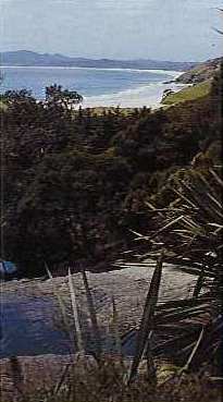
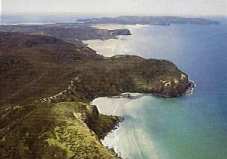
Tapotupotu
Spirits Bay, from Pandora
The combined reserves forming Te Paki Farm Park have a total area of 23,000ha of some of the most extraordinary land forms in New Zealand. They comprise most of the area stretching across the northernmost tip of the Aupouri Peninsula from Cape Maria Van Diemen in the west to North Cape in the east. The Maoris call this piece of land Te Hiku o te Ika. (the tail of the fish) from the legend that tells how a giant fish (the North Island) was pulled from the sea by Maui while he sat in his canoe (the South Island). Geology, however, has a different tale. The rocks composing the uplands in the Cape Reinga-North Cape region were formed by marine vlocanoes and sediment about 60 million years ago and later overlaid by marine deposits. Between 2 and 5 million years ago, they formed an island separated from the mainland by a shallow sea containing other small upthrusted islands. Then, about a million years ago, sand, moved northward by the submarine currents along the coasts of the North Island, built up into long sandspits (tombolos) joining the islands together and to the region around the town of Kaitaia.
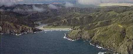
The areas of the park are bordered on three sides by a convoluted coastline. Long gentle curves of sandy beaches are indented by craggy cliffs and sharp, rocky inlets. The west coast includes the last portion of the great sweep of Ninety Mile Beach which runs for an actual 102 kilometres in an uninterrupted line to end at Scotts Point. Here also, you find the great camel-coloured dunes of sand, whipped up to a height of 100 metres and pushed 5 kilometres inlands by the powerful westerly winds that blow in off the Tasman Sea. Other parts of the coast are carved by wide estuaries where still, shallow water gives rise to swamps of mangrove and rivers seep through the land to form the valuable waterbird habitats of raupo covered wetlands.
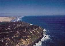
Scott Point and Ninety Mile Beach
Mokaikai Coast
A large part of the hinterland of the coast is an untamed land of ridged hills rising up to 300 metres (Te Paki trig) and dissected by plunging gullies. Much of this area was at one time covered by a rich forest of Kauri, Rimu and Totara trees but at some early stage, and for reasons that are not clear, the forest largely disappeared leaving remnants in some of the deeper valleys which are still there today. These include one excellent stand of Kauri trees just below the Te Paki trig which can be reached by a short walk.
The great sweep of exotic forest visible from parts of the headland is a tract of land that still belongs to the Maoris of the area and separates Te Paki from the North Cape Reserve.
From the lighthouse at Cape Reinga on a clear day, the high rocky promontory of North Cape can be seen 24 kilometres to the east. It marks the northernmost tip of the North Island which, because of it's rare plant and animal life, has been declared a scientific reserve. At the moment, it can only be reached by foot. Lashed by winds, pounded by surf and sand, or soothed by the calm of sunlit days, the whole area of this northern tip of New Zealand has a wild and unpredictable nature. Around it's shores sweep the currents of the Tasman Sea and the Pacific Ocean which meet in a foaming swell of broken water over the Columbia Bank just west of Cape Reinga.
